The biological transition from winter to spring conditions in the Strait of Georgia is characterized by a spring phytoplankton bloom. Inter-annual timing of this phytoplankton bloom can vary by up to 6 weeks (Collins et al. 2009). This broad time range introduces the potential for a mismatch in the timing of the major annual period of zooplankton productivity in the Strait, which can in turn, influence the productivity of higher trophic levels such as fish and sea birds. Understanding the dominant factors influencing the timing of the bloom is therefore the subject of considerable interest (Collins et al. 2009; Allen & Wolfe 2013; Gower et al. 2013).
Alerts
SHOWING 9 RESULTS
Showing matches for "Strait of Georgia"
Spring Bloom Observed in Ferry Data
Overview
These crime solvers are real pigs
Overview
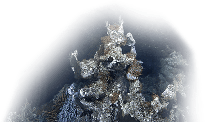
# ONC Spring Expedition 2015 – March 28 to April 2 in the Strait of Georgia Observatory
When the M/V Oceanic Surveyor tied up at the dock in Steveston B.C., forensic anthropologist [Lynne Bell](http://www.sfu.ca/~lynneb/) was eagerly awaiting the tray of bones from pig carcasses #15 and #16, retrieved from Ocean Network Canada’s Strait of Georgia east observatory site.
Spring bloom arrives early this year
Overview
Every spring, plant-like cells known as phytoplankton will grow in number so rapidly and to such an extent that in many coastal areas such as British Columbia's Strait of Georgia, the water colour will become visibly green. This annual burst in productivity is referred to as the spring phytoplankton bloom. And this year, the bloom was the earliest we've had since 20051.
Ocean Networks Canada maintains a mobile observatory system on two BC Ferries vessels that transit the Strait of Georgia up to eight times daily between Vancouver Island and the lower mainland. Instruments on board measure water properties and the amount of plankton (biomass) at the surface every 10 seconds, making these data ideal for characterizing conditions that determine where and when the bloom starts.
Ocean Networks Canada teams up with BC Ferries to monitor Canada’s busiest waterway
Overview
NEWS RELEASE
VICTORIA, B.C. — The University of Victoria’s Ocean Networks Canada (ONC) has expanded its world-class ocean observatories to include data collected from three BC Ferries.
With instrumentation in the ferries’ hull and a weather station on deck, scientists can now observe ocean surface properties continuously while the ferries transit the Strait of Georgia between Vancouver and Vancouver Island.
The strait is a vital waterway to understand. Not only is it Canada’s busiest trade route, it’s home to the world’s largest commercial salmon fishery, important habitat for herring to spawn and grow, and one of the largest overwintering areas for waterfowl in Canada.
It is also a waterway influenced by tides, current and the Fraser River system, which during spring run off, delivers as much as 10,000 cubic metres of fresh water full of fresh silty water into the Strait, in a plume that can cover 10 sq km—a phenomenon visible from the [space station](http://earthobservatory.nasa.gov/IOTD/view.php?id=85028).
“With all three ferry crossings in place, ONC now offers a comprehensive overview of the surface waters of this important body of water,” says Kate Moran, ONC’s president and CEO. “These continuous data are of great interest to scientists in multi-disciplinary studies that span from the dynamic seafloor, currents, waves, and life in the sea.”
ONC’s expansion into BC Ferries, initiated in 2010, is a technological collaboration. The water monitoring system built into the hulls mid-ship measures surface water properties such as oxygen, temperature, salinity, turbidity, and chlorophyll.
A weather station, combined with communications equipment, is mounted on the upper decks and together they capture high-resolution measurements of sea surface and atmospheric conditions every 10 seconds. Data are transmitted over the cellular network and are freely available in real time, via ONC’s website.
The three ferries instrumented are the Queen of Oak Bay (July 2015) the Spirit of Vancouver Island (October 2014) and the Queen of Alberni (May 2012).
“As part of our environmental program, BC Ferries is proud to support ONC in its collection of valuable data to better understand the Strait of Georgia where we operate,” says Mark Wilson, BC Ferries’ vice-president of engineering.
ONC now monitors Strait of Georgia with three BC Ferries
Overview
Ocean Networks Canada (ONC) recently expanded its world-class ocean observatories to include data collected from three BC Ferries.
With instrumentation in the ferries’ hull and a weather station on deck, scientists can now observe ocean surface properties continuously while the ferries transit the Strait of Georgia between Vancouver and Vancouver Island.
Read the news release: [ONC teams up with BC Ferries to monitor Canada's busiest waterway](https://www.oceannetworks.ca/news-and-stories/stories/ocean-networks-canada-teams-up-with-bc-ferries-to-monitor-canadas-busiest-waterway/).
Listening station to study impact of ship noise on whales
Overview
NEWS RELEASE
**Vancouver, B.C.**
The Vancouver Fraser Port Authority (VFPA), with support from the University of Victoria’s Ocean Networks Canada and JASCO Applied Sciences, has deployed a hydrophone listening station that will monitor underwater vessel noise in the Strait of Georgia. Underwater noise has been identified as a key threat to at-risk whales.
Observing Seasonal Marine Changes with BC Ferries
Overview
# BC Ferries takes a closer look at the 2016 spring bloom in the Strait of Georgia
Every year, March brings two kinds of spring blooms to the temperate British Columbia coast: one involves an annual flower count, which is the envy of the country; the other turns the Salish Sea green with an explosion of marine productivity. BC Ferries plays an important role on both counts, bringing visitors across the Strait of Georgia to enjoy the Island’s blossoms while simultaneously hosting Ocean Networks Canada’s (ONC) instruments that collect marine data in the Strait of Georgia.
ONC measures ocean properties at the sea surface using advanced instruments installed onboard three ferry routes. The route from Departure Bay to Horseshoe Bay was instrumented in July 2015, making 2016 the first year all three ferries captured the start and progression of the spring phytoplankton bloom, as measured by chlorophyll concentration and fluorescence (Gower et al, 2013).
The timing and extent of the spring bloom is thought to have a significant influence on the food web in the entire Strait of Georgia ecosystem, making these detailed data essential for truly capturing the spring bloom. The increased geographic coverage enabled by the ferries, along with measurements taken continuously as they sail, helps to magnify our understanding of this annual event.
Monitoring Saanich Inlet and the Strait of Georgia: Fall inshore expedition (2016)
Overview
Twice a year, every spring and fall, Ocean Networks Canada (ONC) heads to sea aboard the Canadian Coast Guard Vessel (CCGV) John Tully to maintain and upgrade ocean monitoring instrumentation in Saanich Inlet and the Strait of Georgia. Between 4 - 11 October 2016, in addition to the infrastructure maintenance priorities of the expedition, the ONC team also successfully deployed new instrumentation, carried out several activities in support of our science community, and collected samples for benchmarking and calibration of instruments.
Delta Dynamics Lab completes final tour of duty
Overview
The Delta Dynamics Lab (DDL), maintained and operated by Ocean Networks Canada, has headed for a well-earned retirement after 21 successful deployments in the Fraser River Delta. The submarine observatory contributed to federal public safety programs related to natural hazards by providing a clearer understanding of the impact of the massive turbidity currents occurring in this region.
The final hoisting of the two-tonne custom-built structure during the [Spring 2024 #ONCabyss expedition](https://www.oceannetworks.ca/news-and-stories/stories/oncabyss-spring-2024-expedition-recap/) caps a 16-year joint geohazard investigation between ONC and Natural Resources Canada (NRCan) at the mouth of British Columbia’s longest river. Here, a nine-kilometre-wide intertidal mudflat off the coast of Metro Vancouver meets a sloping delta front that extends into the Strait of Georgia.
The initiative led by Drs. Gwyn Lintern and Philip Hill, NRCan research scientists and principal investigators for the DDL project, delivered unprecedented near year-round data capturing many of the unique delta processes such as sediment plume dynamics, underwater landslides, and the transfer of land-based sediment to the deep Salish Sea through turbidity currents.
The scale of the sediment transfer is significant. NRCan worked closely with UK researchers who have calculated that a single offshore turbidity current can move more sediment into the deep ocean than all the planet’s rivers combined. The Fraser River itself deposits over seven million tons of sediment annually during the spring freshet between May and June.
Stay up to date with ONC
Subscribe
Ocean-Climate Building University of Victoria
#100, 2474 Arbutus Road, Victoria, BC, Canada, V8N 1V8
info@oceannetworks.ca+1 (250) 472-5400Marine Technology Centre University of Victoria
#106, 9865 West Saanich Road, North Saanich, BC, Canada, V8L 5Y8
info@oceannetworks.ca+1 (250) 472-5400@ 2025 Ocean Networks Canada. All rights reserved.