# ONC Spring Expedition 2015 – March 28 to April 2 at the Strait of Georgia Observatory
One of the major goals of this spring expedition was to lay one kilometre of new fibre optic cable at the Delta Dynamics Lab (DDL) as the original copper-based wire had reached maximum capacity for data transfer. [Natural Resources Canada](https://www.nrcan.gc.ca/home) (NRCan) has been working with DDL data since 2008 and also providing ship time for one expedition per year on the coastal observatory to assist with ONC’s science projects.
Alerts
SHOWING 3 RESULTS
Showing matches for "Delta dynamics lab (DDL)"
Newer, greater capacity for the Delta Dynamics Lab
Overview
Tumbling to success: delta dynamics laboratory becomes scientific highlight
Overview
How do you study a moving wall of water and sediment the size of a truck traveling at 30 kilometers per hour? A paper about a spectacular Ocean Networks Canada (ONC) dataset was recently selected as one of science journal Sedimentology’s [Top 10 articles of 2016](http://onlinelibrary.wiley.com/journal/10.1111/(ISSN)1365-3091/homepage/editors__pick_2015.htm), as an example showcasing “good practice, innovative approaches, and noteworthy advances of our science.” Congratulations to marine geoscientist Gwyn Lintern (Figure 1) and colleagues from Natural Resources Canada who published this paper on the [tumbling delta dynamics laboratory platform](http://onlinelibrary.wiley.com/doi/10.1111/sed.12262/full).
Delta Dynamics Lab completes final tour of duty
Overview
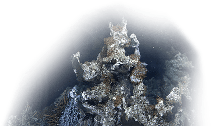
The Delta Dynamics Lab (DDL), maintained and operated by Ocean Networks Canada, has headed for a well-earned retirement after 21 successful deployments in the Fraser River Delta. The submarine observatory contributed to federal public safety programs related to natural hazards by providing a clearer understanding of the impact of the massive turbidity currents occurring in this region.
The final hoisting of the two-tonne custom-built structure during the [Spring 2024 #ONCabyss expedition](https://www.oceannetworks.ca/news-and-stories/stories/oncabyss-spring-2024-expedition-recap/) caps a 16-year joint geohazard investigation between ONC and Natural Resources Canada (NRCan) at the mouth of British Columbia’s longest river. Here, a nine-kilometre-wide intertidal mudflat off the coast of Metro Vancouver meets a sloping delta front that extends into the Strait of Georgia.
The initiative led by Drs. Gwyn Lintern and Philip Hill, NRCan research scientists and principal investigators for the DDL project, delivered unprecedented near year-round data capturing many of the unique delta processes such as sediment plume dynamics, underwater landslides, and the transfer of land-based sediment to the deep Salish Sea through turbidity currents.
The scale of the sediment transfer is significant. NRCan worked closely with UK researchers who have calculated that a single offshore turbidity current can move more sediment into the deep ocean than all the planet’s rivers combined. The Fraser River itself deposits over seven million tons of sediment annually during the spring freshet between May and June.
Stay up to date with ONC
Subscribe
Ocean-Climate Building University of Victoria
#100, 2474 Arbutus Road, Victoria, BC, Canada, V8N 1V8
info@oceannetworks.ca+1 (250) 472-5400Marine Technology Centre University of Victoria
#106, 9865 West Saanich Road, North Saanich, BC, Canada, V8L 5Y8
info@oceannetworks.ca+1 (250) 472-5400@ 2025 Ocean Networks Canada. All rights reserved.